Tag Archives: harbour

Pictures from the Sydney waterfront

This post is a collection of various pictures from around Sydney Harbour that I’ve been collecting as I’ve been here.In my opinion, the waterfront is the best feature of Sydney –  the city isn’t wildly exciting to me, it’s a somewhat generic large city, however the waterfront adds some uniqueness and difference to it and there’s always something different taking place on the water.

Sydney CBD and bridge in the hazy distance.

Sydney CBD and bridge in the hazy distance.

A water ferry cruises through Darling Harbour, near the maritime museum.

A water ferry cruises through Darling Harbour, near the maritime museum.

View out from Pyrmont towards the Harbour Bridge.

View out from Pyrmont towards the Harbour Bridge.

They put everything on barges here... I've seen party barges, crane barges, cement mixer barges even a soccer field barge (!!).

They put everything on barges here… I’ve seen party barges, crane barges, cement mixer barges, a soccer field barge and even a barge full of strippers and sleazy bankers. :-/

Sydney's military port - I really want to find out what they use that massively bulky crane to lift - tanks maybe?

Royal Australian Navy’s primary dock – I really want to find out what they use that massively bulky crane to lift – tanks maybe?

One of the smaller ferries comes in to dock at Circular Quay.

One of the smaller ferries comes in to dock at Circular Quay.

Pulling away from Circular Quay on the Manly Ferry

Pulling away from Circular Quay on the Manly Ferry

All hail duck kind!

Bow before Lord Carr and his mighty duck army!

Mysterious discharge from a mysterious pipe slung under a pier.

Mysterious discharge from a mysterious pipe slung under a pier.

Looking out towards Pyrmont as the sun sets.

Looking out towards Pyrmont as the sun sets.

Sydney Harbour Bridge Walk

One of my biggest annoyances about living in Auckland is that the only way to cross the Auckland Harbour Bridge was via car or bus –  so whilst my apartment would have been within feasible walking distance to the city, it was utter impossible to walk it.

Sydney has at least got this right and their famous harbour bridge is crossed by car, train, cycle and foot, which offers an excellent chance to see the bridge up close and get some amazing views over the city and harbour.

Views don’t get much more iconic than this. Amazingly hot dude and some building thingy in the background.

It’s an easy walk to get to if you’re a tourist – you just need to take the Northern Rail line Central, Wynward or Town Hall train stations and depart at the Milsons Point railway station on the North Shore, which is right where the bridge crossing starts for both pedestrians and cyclists.

Both the train and driving across the bridge offer views, but it’s nowhere near as excellent as checking it out on foot – and of course driving across will incur you some lovely tolls.

It’s hard to get a sense of scale – for reference there are two rail lines running through the right side tower, each capable of fitting a double decker train though it – or in the case of the left side, a road lane and a pedestrian path.

If I find my current 1 bedroom CBD apartment rent painful, I’d hate to think how much these places would be costing…

Sydney Opera House!

There’s one metric fuckload of steel in this.

It’s also really high!

Circular Quay, the international passenger terminal for cruise ships and the rocks.

I love these apartments at the city end of the bridge for being a neat varying stack of towers and roof gardens, but at the same time hate it’s blocky concreteness.

Interspersed concrete and greenary awaits at the end of the crossing – descend the steps to end up in “The Rocks”, the heritage part of Sydney

The crossing is well worth doing, it’s a real shame that Auckland hasn’t added a walk and cycleway of their own – not only is it a great recreational addition, but it also makes the lifestyle choice of walking or cycling to work from the North Shore feasible.

Up Mt Kaukau

When I was in Wellington last month I caught up with my good mate Tom (of #geekflat fame) and we decided to go for a wander up Mt Kaukau with Tom’s friend Nicola.

I spent most of my years in Wellington focusing on the CBD and southwards, so Johnsonville, Khandallah and it’s surrounding walks are quite new to me.

We took the route up from Johnsonville, going up to the peak and then back down into Khandallah side, before walking back through the suburbs, near the rail line, to Johnsonville.

The Wellington City Council has a good map of the Northern Walks available for download showing the route, I also quickly whipped up a rough Google map of the start & exit points I took along with the route diagram. I should really record more GPS accurate tracks with my phone, but that stuff loves chewing up the battery quickly so not always possible.

Starting out climb up....

It's a @macropiper! By a tunnel! (Turns out this tunnel is for the old water reservoir pipe).

TV transmission tower in the distance - it's visible clearly down on street level in Johnsonville and looks a long way away from there - not really too hard getting there though.

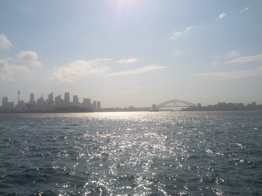
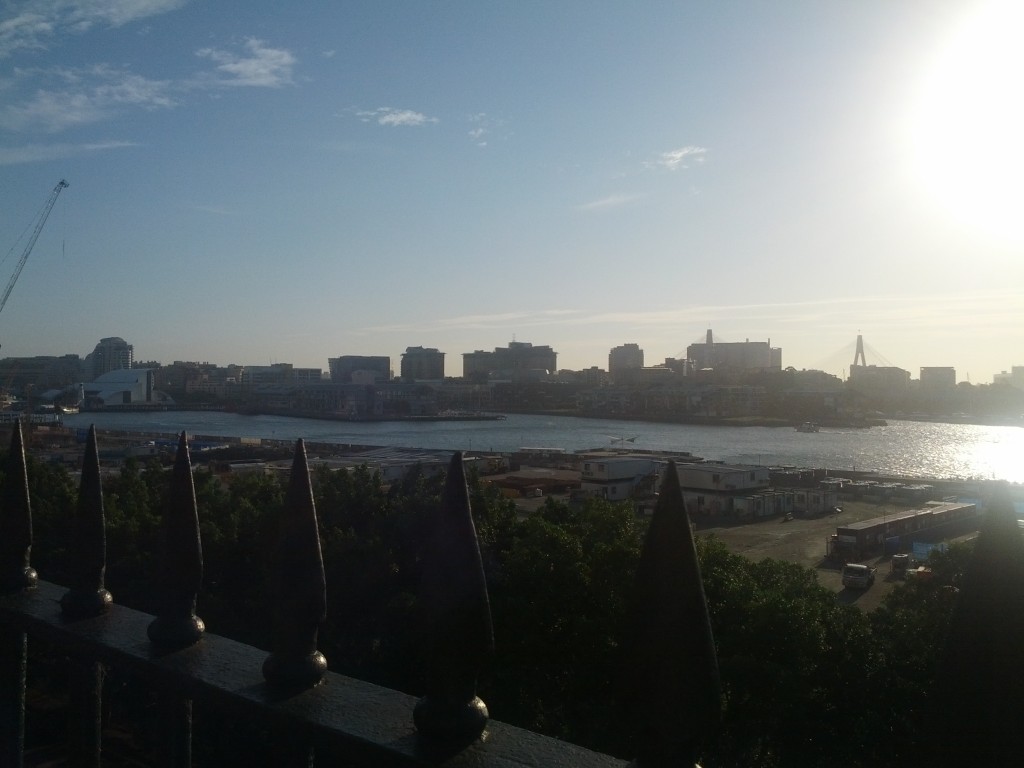
It's Welly! So pretty!

Uh-oh, what has Tom found?

Not a kitteh!

Will these landmark TV transmission towers still be relevant in 25 years time after everything has been replaced with IP over fibre?

I love this city!

Wellington suburbs lapping at the foothills.

Harbour view, love the trail of the turning cargo ship.

Panorama view over the harbour, CBD, surburbs and out towards Makara in the far right. Not very visable is the large wind farm out that way. Pictures don't really do the view from up here justice.

Anyone know what this weird tree is?

Johnsonville rail line

It was a pretty good walk all up, not to long or taxing, but with a rewarding view and an excuse to wander through the suburbs for the first time.

We came across a few promising looking cafes hidden in weird places in the suburbs whilst on the return walk, if I have more time in Wellington again soon I wouldn’t mind checking a few of them out, particularly one which was busy pulling home made pies out of the oven….

If you take a look at the council map for the Northern Walkway, it’s actually possible to walk all the way from Johnsonville to the Botanic gardens, staying mostly in parks with a few detors through streets. This route is also part of the Te Araroa walk, so good practice for me for when I’m ready to do it. :-)